Now that we’ve covered the entirety of the west coast (and a little more), I want to take a little time to re-cap everything that we did, as well as add in our overall thoughts about the West Coast Region of New Zealand. The West Coast region reaches from Kahurangi Point in the north to Awarua Point in the south, and is over 600 km (~375 miles) long. After spending time in the Tasman region, at both Abel Tasman and Nelson Lakes National Park, we began our journey down the west coast of the country.
Pancake Rocks, or Punakaiki, was the first stop down along the coast, and even though the weather was not the best while we were there, I think it worked in our favor. The windy weather caused the ocean to be a more rough than usual, making the blowholes and crashing waves all the more impressive. Even with our rain jackets zipped all the way up, and our (gloveless) fingers absolutely freezing, we had an absolute blast walking around the rockscapes and watching the waves crash around us.

In the same spirit of wind and crashing waves, our campsite for the night in Greymouth, was not at all a pleasant experience. Even still, it is the worst night we have had in the van. The rain was pounding down on every side, and the wind was so strong the van was literally rocking. It didn’t help that we had decided to park right up by the shoreline so that we could see the sunset (hidden by the clouds), and didn’t have the foresight to move back. I am sure that Greymouth is a lovely area, but while we were there it definitely lived up to its name, grey.
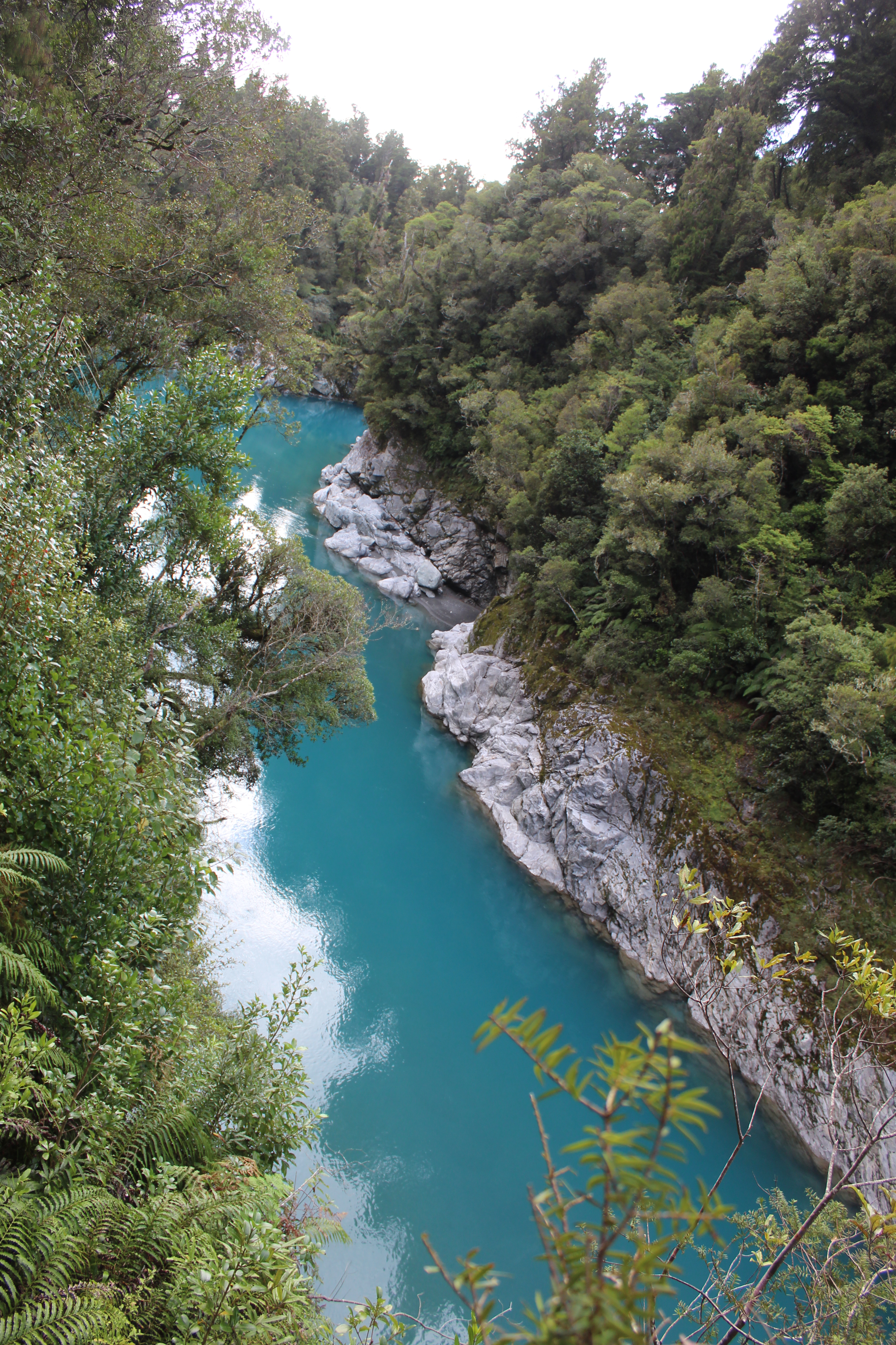
Continuing on, we came to Hokitika Gorge next, and the weather was finally seeming to cooperate for us a little more. I had never heard of glacial flour before seeing this gorge, and now Eric and I are pointing it out in every glacial lake, stream, and river we come upon. I have never seen water the color of Hokitika, and the white rock walls on either side made it one of the most picturesque places we have seen.

This brings us to the highlight of the West Coast region, at least for me. The two glaciers: Franz Josef and Fox. We only spend a couple days in each of the towns, and did more hiking that we have done in a long time. These were a couple of the hardest hikes we have done on this trip, and we were not expecting to hike through ankle deep snow so early in the trip, but it was a once in a lifetime experience and led to the most incredible views. Alex’s Knob and Lake Marian may go on to be some of my personal favorite hikes ever, competing with Angel’s Landing in Zion and Delta Lake in the Tetons.

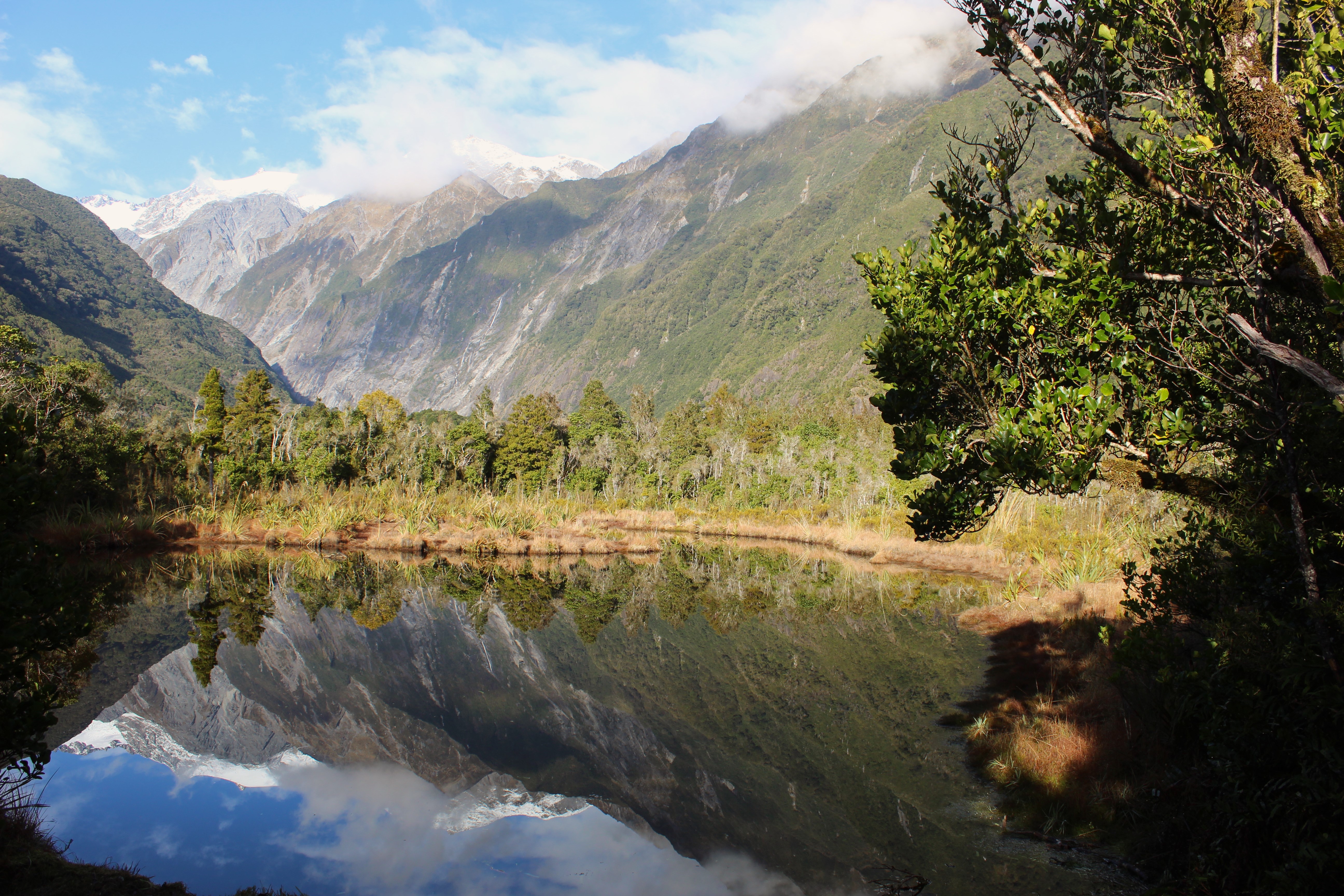
There were several kettle and mirror lakes that we came upon along our drive. All of them absolutely had the potential to be truly spectacular if the water was totally still. However, we noticed that the ducks also seem to love the mirror lakes, and were almost always playing in the water, causing the water to ripple and splash. Eric and I didn’t mind at all, and enjoyed watching the ducks dive and swim around. Some other tourists trying to get the perfect reflection photo, however, were not impressed with the duck antics.

Finally, heading out of the West Coast and into the Otago region took us over the Haast Pass. After yet another night of pouring rain, we were in for a little treat going through this pass. This pass is supposedly already known for the many waterfalls along it, and with the weather, we were incredibly lucky that there were even more waterfalls visible than usual. We definitely try to make the most out of every day, and while we were initially nervous to be driving this pass on such a rainy and gross day, it turned out to be tons of fun and we got to see so many different waterfalls, that it was really quite the experience.
Overall, the West Coast region was the rainiest region that we have been in so far, but the glaciers, lakes, rocks, and waterfalls still made for an incredible journey and fun stories.


Leave a comment